

%20CREDIT%20VanuatuPocketGuide.com.webp?v=2026-03-07T22%3A49%3A25.000Z)
Where is Vanuatu?
Discovering Vanuatu has to start somewhere and its location is as good a place as any… So, where is Vanuatu located? Vanuatu is an independent island nation located in the Oceania region of the South Pacific Ocean.
Picture this: you're floating in the heart of the South Pacific, roughly 1,750 km (1,087 mi) east of northern Australia's coastline. That's where you'll find Vanuatu, perfectly positioned about 500 km (311 mi) northeast of New Caledonia and sitting pretty 1,300 km (808 mi) west of Fiji.
This stunning archipelago is surrounded by fellow Melanesian neighbours, creating quite the island-hopping paradise.
What makes Vanuatu particularly fascinating is its makeup of around 83 mostly volcanic islands stretching in a graceful north-south chain. We're talking about a total land area of approximately 12,189 km² (4,706 mi²) scattered across some seriously beautiful Pacific waters.
Understanding Vanuatu's location helps you appreciate just how special this destination truly is, and we'll explore exactly what makes it so remarkable in this guide.
This article is based on real on-the-ground research, not on AI scraping old content from the internet. Learn how we use AI!
Table of Contents
Quick Facts About Vanuatu
Population: 335,000-338,000 (2025)
Landmass: 12,189 km² (4,706 mi²)
Languages: Bislama, English, French
Capital: Port Vila
Currency: Vanuatu Vatu (VAV)
Famous for: Stunning volcanic landscapes, the Tanna and Ambrym active volcanoes, lush rainforests, fabulous beaches like Champagne Beach, diverse cultures like the Small Nambas, a relatively low‑key tourism scene, excellent hiking and diving spots like SS President Coolidge, and being an independent island nation in the South Pacific.
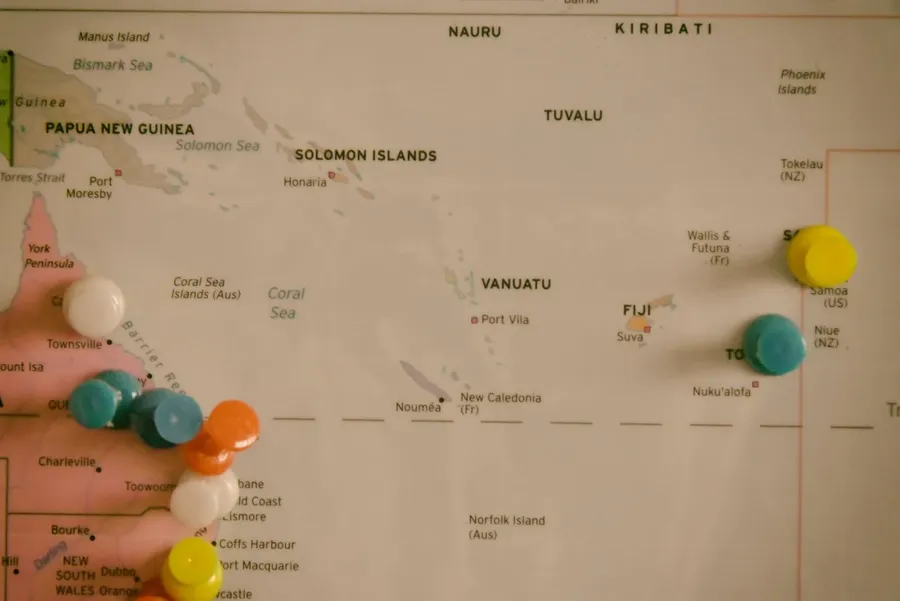
Where is Vanuatu on the World Map?
Vanuatu is located in Oceania in the Southern Hemisphere.
This independent island nation lies in the South Pacific Ocean, about 1,750 km (1,087 mi) east of northern Australia and roughly 500 km (310 mi) northeast of New Caledonia. It stretches in a north-south chain of islands, situated approximately 15-20° south of the Equator.
The South Pacific Islands Near Vanuatu
Vanuatu is surrounded by other South Pacific islands and nations: New Caledonia lies closest at around 538 km (334 mi) to the southwest, Fiji is about 1,192 km (741 mi) to the east, and the Solomon Islands sit roughly 1,286 km (799 mi) to the north.
%20CREDIT%20VanuatuPocketGuide.com-900x600.webp?v=2026-03-16T17%3A53%3A33.019Z)
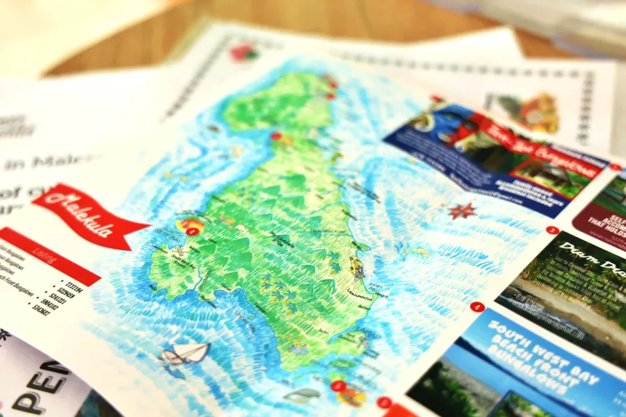
How Big is Vanuatu?
Vanuatu covers a land area of approximately 12,189 km² (4,706 mi²).
It consists of around 83 islands, of which about 65 are inhabited. The largest and most populated islands are Espiritu Santo at around 3,955 km² (1,527 mi²), Efate at around 899 km² (347 mi²), which includes the capital Port Vila, and Malekula at around 2,041 km² (788 mi²).
Learn more about the islands in our guide, The Best Islands & Provinces to Visit in Vanuatu.
Note that Vanuatu is an independent nation, distinct from nearby island countries such as Fiji, New Caledonia and the Solomon Islands.
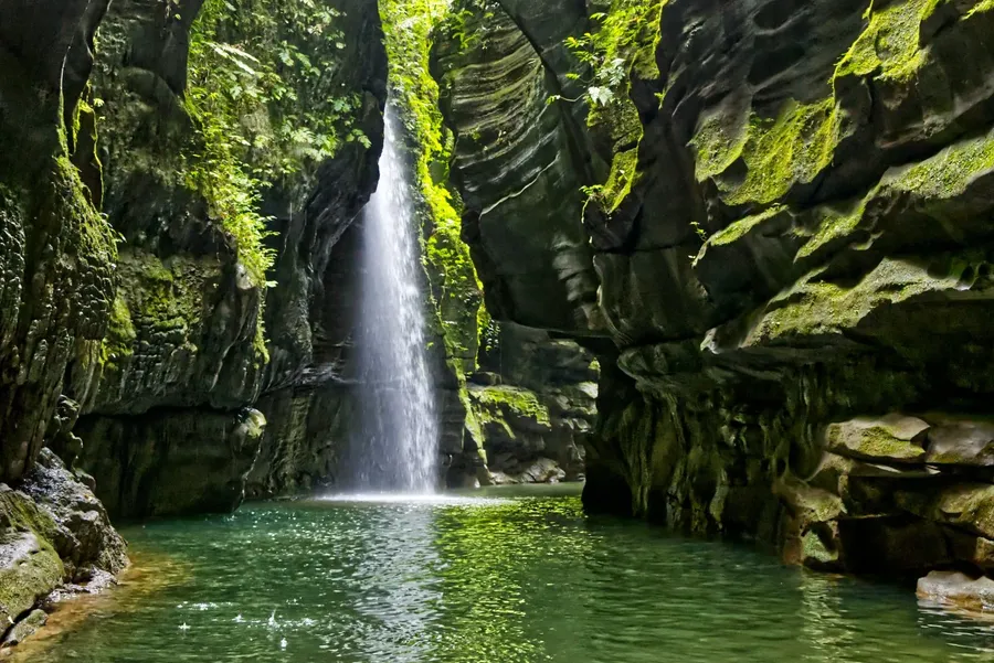
Geography of Vanuatu
Vanuatu is made up of around 83 islands, mostly volcanic, characterised by mountainous terrain, active volcanoes, lush rainforests and narrow coastal plains.
The largest island, Espiritu Santo, is home to one of the country’s major towns and features dramatic peaks, rivers with cave systems and bays.
To the south lies Efate, and is where the capital Port Vila is located, known for its sheltered harbours and surrounding volcanic hills.
Other notable islands include Malekula, Tanna, Ambrym and Pentecost, each famous for striking cliffs, traditional villages, and unique cultural practices. Some of these islands are still substantial.
The highest peak in Vanuatu is Mt Tabwemasana on Espiritu Santo, reaching 1,836 m (6,027 ft).
Several smaller islands and islets, including some coral atolls, complete the archipelago, many of which are uninhabited or serve as wildlife sanctuaries.
Frequently Asked Questions About the Location of Vanuatu
Here are the answers to some of the most commonly asked questions about the location of Vanuatu.
Where is Vanuatu Located?
Vanuatu is located in the South Pacific Ocean, in the continent of Oceania. It lies east of Australia, northeast of New Caledonia, west of Fiji, and south of the Solomon Islands.
What Country Does Vanuatu Belong To?
Vanuatu is an independent island nation. It gained independence from France and the United Kingdom in 1980 and governs its own internal and international affairs.
What is the Physical Geography of Vanuatu?
Vanuatu consists of mostly volcanic islands with mountainous terrain, active volcanoes, narrow coastal plains, lush rainforests, and coral atolls. Its landscape is dramatic and rugged, with notable peaks such as Mt Tabwemasana on Espiritu Santo.
Where is Vanuatu in Relation to New Zealand?
Vanuatu is located about 1,750 km (1,088 mi) east of northern Australia and roughly 2,600 km (1,616 mi) northeast of New Zealand in the South Pacific Ocean.
Which Countries are Closest to Vanuatu?
The closest countries to Vanuatu are New Caledonia (approximately 538 km / 334 mi southwest), Solomon Islands (about 1,286 km / 799 mi north), and Fiji (around 1,192 km / 740 mi east).
More About Where Vanuatu is Located
That's it for our guide on where Vanuatu is located but by no means the end of our interesting facts about the islands. In fact, we have more articles for your reading pleasure:
And if you're planning a trip to Vanuatu, don't miss our 30 Tips for Travelling in Vanuatu.

%20CREDIT%20VanuatuPocketGuide.com-900x601.webp?v=2026-06-11T01%3A28%3A52.090Z)
-CUNL%20CREDIT%20VanuatuPocketGuide.com-900x600.webp?v=2026-03-08T01%3A22%3A10.914Z)